Long Island bike map
You can find on this page the Long Island bike map to print and to download in PDF. The Long Island bicycle map presents the bike routes and lanes of Long Island in New York - USA.
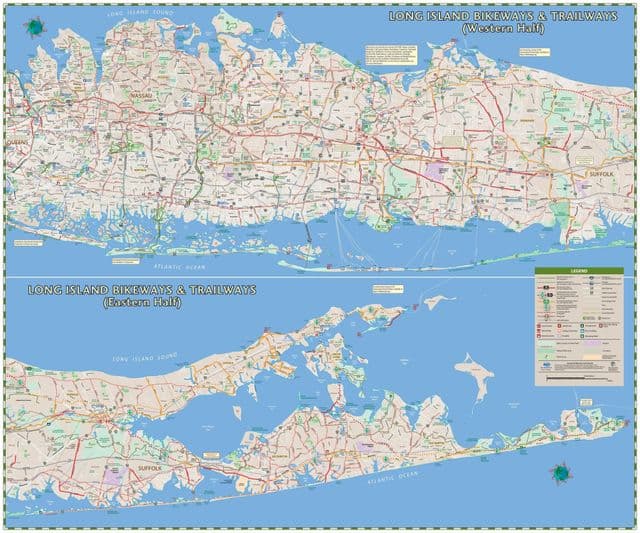
Long Island bike lane map
The Long Island bike lane map shows all the bike routes of Long Island. This bicycles lanes map of Long Island will allow you to easily plan your routes with a bike in Long Island in New York - USA. The Long Island bike lanes map is downloadable in PDF, printable and free.
Bike lanes are shoulders or travel lanes where motorists and bicyclists must respect each others legal rights of a “shared roadway”. While the regional corridor system of State bike routes is intended to provide high quality bicycling facilities, it should not be misconstrued that the mere signage or even bike lane delineation will provide complete protection for all bicyclists. NY 24 State Bike Route as you can see inLong Island bike lane map begins at the Riverhead Traffic Circle and proceeds east through the Pine Barrens and along Peconic Bay on designated bicycle lanes to as far as Old Riverhead Road, just north of Sunrise Highway. NY 25 State Bike Route begins at the intersection of NY Route 25, NY Route 25A and NY Route 111, a half mile east of the Town of Smithtown central business district and it continues northeast along NY Route 25A and then diverts to local roads in St James, Stony Brook and Setauket, and briefly rejoins NY Route 25A in Setauket.